

Spotlight on technology
By Callen Thompson, Extension Agronomist, Katherine
This is a new segment in the Katherine Rural Review that will identify apps, gadgets and websites that Department of Primary Industry and Resources staff come across and find useful. In this edition, I will talk about a website that I have been using a lot over the last couple of months, Green Precision.
Green Precision is a web based tool that allows the user to see a Normalised Difference Vegetation Index (NDVI) image at any point in the world for a selected month and year. NDVI maps allow the user to see variation in vegetation across paddocks or properties and across seasons.
I find this particularly useful when I am looking at a paddock to put a trial in, as it allows me to see where the better part of the paddock is and where the paddock is most uniform. Horticulturalists, farmers and pastoralists grazing improved pasture could use this technology to see variations in their paddocks and farms. They can then investigate why there are differences between good and bad areas through conventional methods such as soil testing or tissue testing.
This tool also allows producers to see the impact of changes in practice, for instance fertiliser test strips or changes in irrigation scheduling.
The NDVI maps from Green Precision are coarser than what you would get using other forms of remote sensing such as a multi spectral camera on a drone, but it is a great first step to understand variation in your paddocks. Best of all, it is currently free!
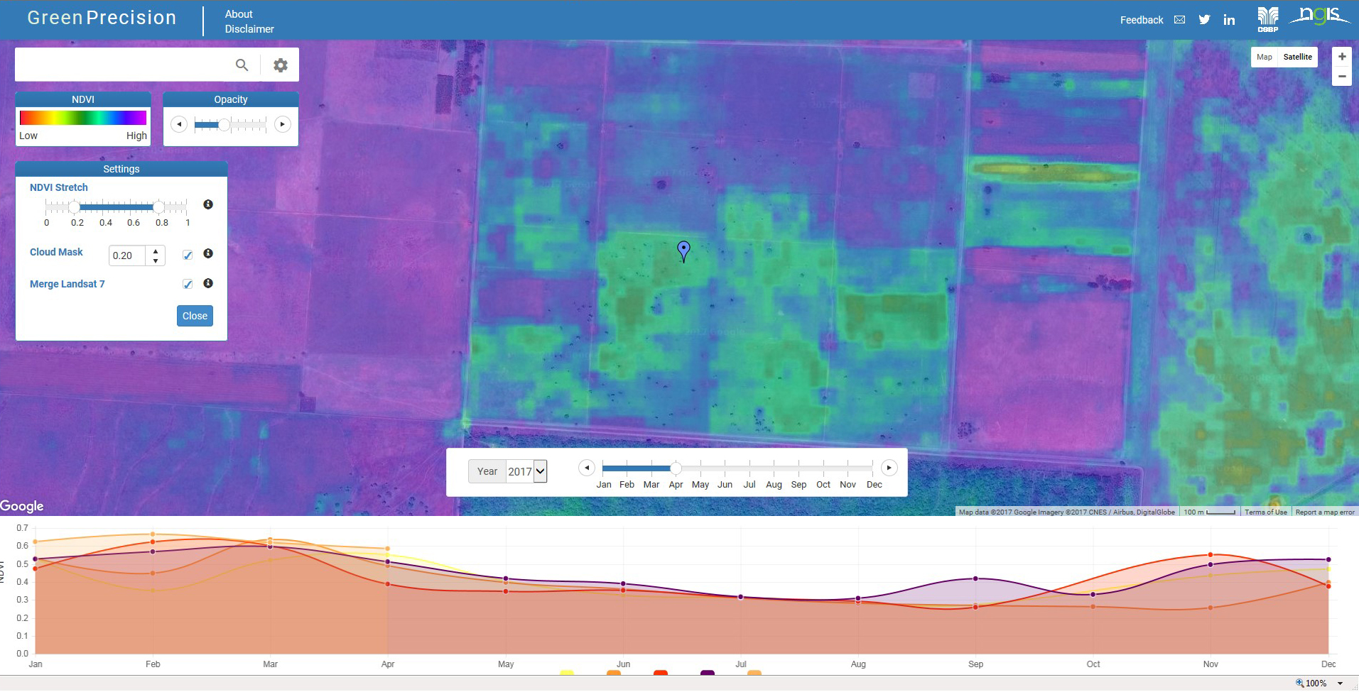
The image above shows the cell grazing trials at Douglas Daly Research Farm April 2017. The green areas have been recently grazed while the purple areas are yet to be grazed and have more vegetation.
Give feedback about this page.
Share this page:
URL copied!