

Feed management goes high tech
An increasing number of Territory cattle producers are using cutting edge technology to manage their operations. From remote water monitoring to individual animal performance recording, there is so much useful technology available to large-scale beef enterprises across northern Australia.
One of the most exciting new developments is access to reliable estimates of the feed supply using satellite data. Territory Natural Resource Management (TNRM) recently obtained funding from the Australian Government Future Drought Fund to test this new technology with Northern Territory (NT) cattle producers. In partnership with CiboLabs Pty Ltd, the Northern Territory Cattlemen’s Association and the Northern Territory Government, producers from all over the NT are trialling this new product and providing feedback to increase its accuracy. One of the biggest benefits of this “birds eye view” is being able to see all parts of the property, not just the parts along the station tracks.
Producers involved in the project have already identified numerous opportunities to improve decision-making around the feed supply. One plans to use the satellite data to adjust the order that paddocks are mustered based on the quantity and greenness of the feed. Another has found the product very useful for seeing where remote storms have passed through and where the feed has responded as a result. Others have recognised that the technology can provide an independent estimate of the feed supply for their organic audit reporting. By getting information about the feed situation every 5 days, it is now easier to work out how many cattle can be run and to predict how long the feed will last in different paddocks.
TNRM is seeking 2 final participants for the project, which will run until June 2022. Most regions are well-represented, but we are particularly keen to engage with family-owned and operated businesses in the Tennant Creek and Roper Gulf regions.
Contact Dionne Walsh at dionne.walsh@territorynrm.org.au if you would like to express your interest!
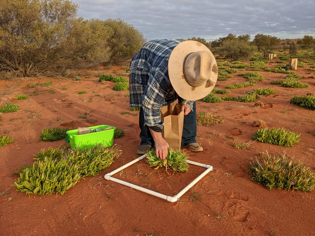
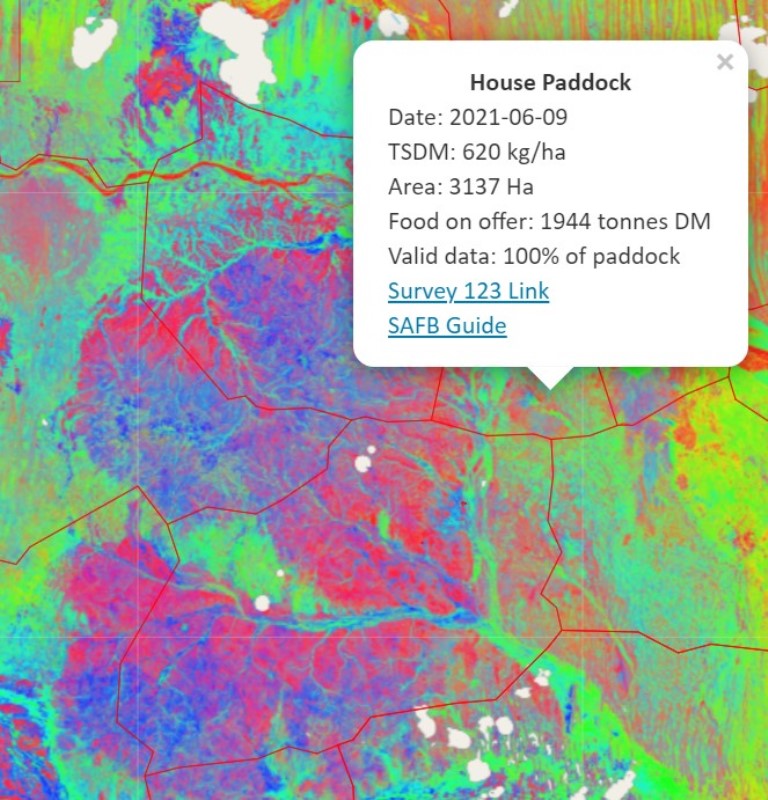
Image 2: Colleen Costello from Crown Point Pastoral assessing the parakeelya response at Andado Station.
Image 3: Example of CiboLabs forage mapping showing different land types and feed levels.