

Geophysical acquisition
This guide has information on regional gravity and airborne surveys undertaken by the Northern Territory Geological Survey (NTGS).
Geophysical acquisition programs include the capture and interpretation of regional gravity programs.
For recent and upcoming geophysical data acquisition visit the Resourcing the Territory website.
Regional gravity
The NTGS has commenced a program of semi-regional gravity surveys over selected areas that have unresolved geological problems and unrealised mineral potential.
There is growing awareness in the exploration industry that semi-regional gravity surveys can assist greatly in understanding rock distribution in the mineable zone.
Territory-wide gravity
NTGS conducts major regional gravity surveys, adding the resulting observations to the Geoscience Australia National Gravity Database.
Regions of interest can be downloaded from the Geophysical Archive Data Delivery System (GADDS).
Gravity images for the whole of the Northern Territory can be viewed on the Geophysical Image Web Server, by selecting "NT wide images", "gravity" and can also be viewed in conjunction with other geophysical images.
The NT-wide gravity images can also be made to underlie a wealth of other geoscience information provided by NTGS via STRIKE.
Airborne surveys
Since 1981, NTGS has been flying magnetic and radiometric surveys over mineral fields and basement terrains.
These surveys progressively replaced the old reconnaissance magnetic coverage by the Bureau of Mineral Resources (now Geoscience Australia).
Early surveys were acquired on 500m line spacing and collected four windows of radiometrics, without the benefit of precise control in x-y-z.
These surveys evolved in the early 1990s into a standard specification of high-resolution 400 m line spacing, with precise location control by DGPS, collection of elevation data and 256 channel radiometrics.
As of mid 2007, over 96% of the Northern Territory is covered by 57 separate surveys, including 3 surveys flown by Geoscience Australia.
Existing datasets
Existing NTGS and Geoscience Australia high-resolution surveys are shown on the NTGS airborne geophysical index map.
The geophysical survey index map and the gravity survey index map show the coverage areas of all the surveys. Images from the survey data and magnetic , radiometric, gravity and elevation maps of the Northern Territory are available for viewing on our Geophysical Image Web Server
Located data and grids for individual NTGS and Geoscience Australia surveys can be requested from the InfoCentre or downloaded from GADDS
Past surveys
For recent and upcoming geophysical data acquisition go to the Resourcing the Territory initiative.
Delamere and Spirit Hills Airborne Magnetic and Radiometric Survey 2015The Delamere and Spirit Hills Magnetic and Radiometric Survey covers two areas in the north-west of the Northern Territory over the Daly and Victoria basins. The westernmost Spirit Hills portion covers approximately 8,500 square km while the more eastern Delamere portion covers over 25,000 square km. The airborne survey acquired magnetic, radiometric (gamma-ray) and elevation data along 400 m spaced lines resulting in over 95,000 line km of new data. Survey acquisition was completed in November 2015 with final data release in March 2016. | 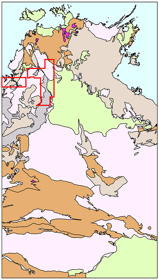
|
Northern Wiso Gravity Survey 2015The Northern Wiso Gravity Survey in northern Australia was acquired from June to August in 2015. The survey covers an area of approximately 80,000 square km and involved almost 5000 helicopter-supported ground gravity stations on a 4 km spaced grid. The data was released 17 October, 2015. | 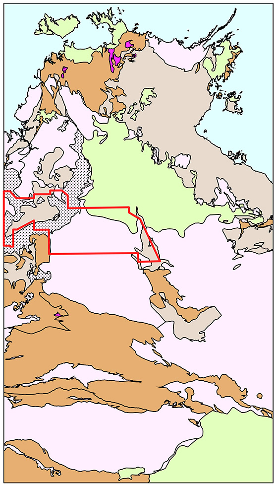
|
Victoria Basin Gravity Survey 2015The Northern Territory Geological Survey acquired a regional gravity survey over the Victoria Basin in western central Australia in August and September 2015. The survey covered an area of over 99,000 km2 and involved almost 6200 helicopter-supported ground gravity stations on a 4 km spaced grid. With the completion of this survey the CORE initiative has acquired new gravity data over almost 600,000 square km of the Northern Territory. The data was released 10 November, 2015. | 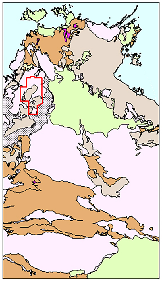
|
Dunmarra Airborne Magnetic and Radiometric Survey 2014The Dunmarra geophysical survey is the first airborne magnetic and radiometric survey to be flown under the CORE initiative, and covers an area of approximately 36,280 km2 in central Northern Territory, between Katherine and Tennant Creek. It is located on the south-east margin of the McArthur Basin and encompasses a large portion of the Beetaloo sub-basin. The airborne survey collected magnetic, radiometric (gamma-ray) and elevation data along 400 m spaced lines resulting in over 100,000 line km of new data. | 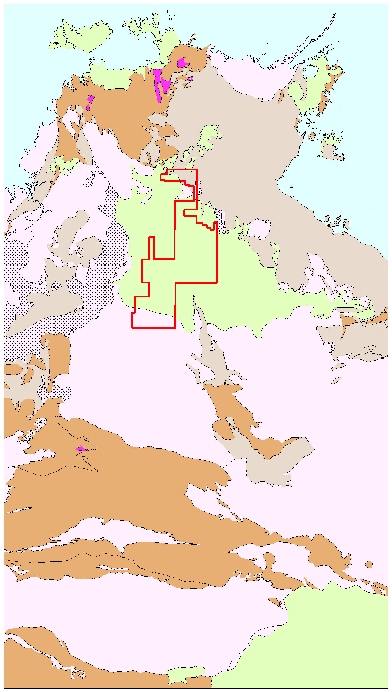
|
West Amadeus Basin Gravity Survey 2014The West Amadeus Basin Gravity Survey completes modern gravity coverage in the south-western region of the Northern Territory and consists 8000 ground gravity stations at station spacing ranging from 4 km to 500 m. The survey area extends from the Western Australia and South Australia borders for approximately 45,050 square km. This is the third gravity acquisition funded under the CORE initiative and includes collaboration with industry for extensive infill over nearly 50% of the survey area. | 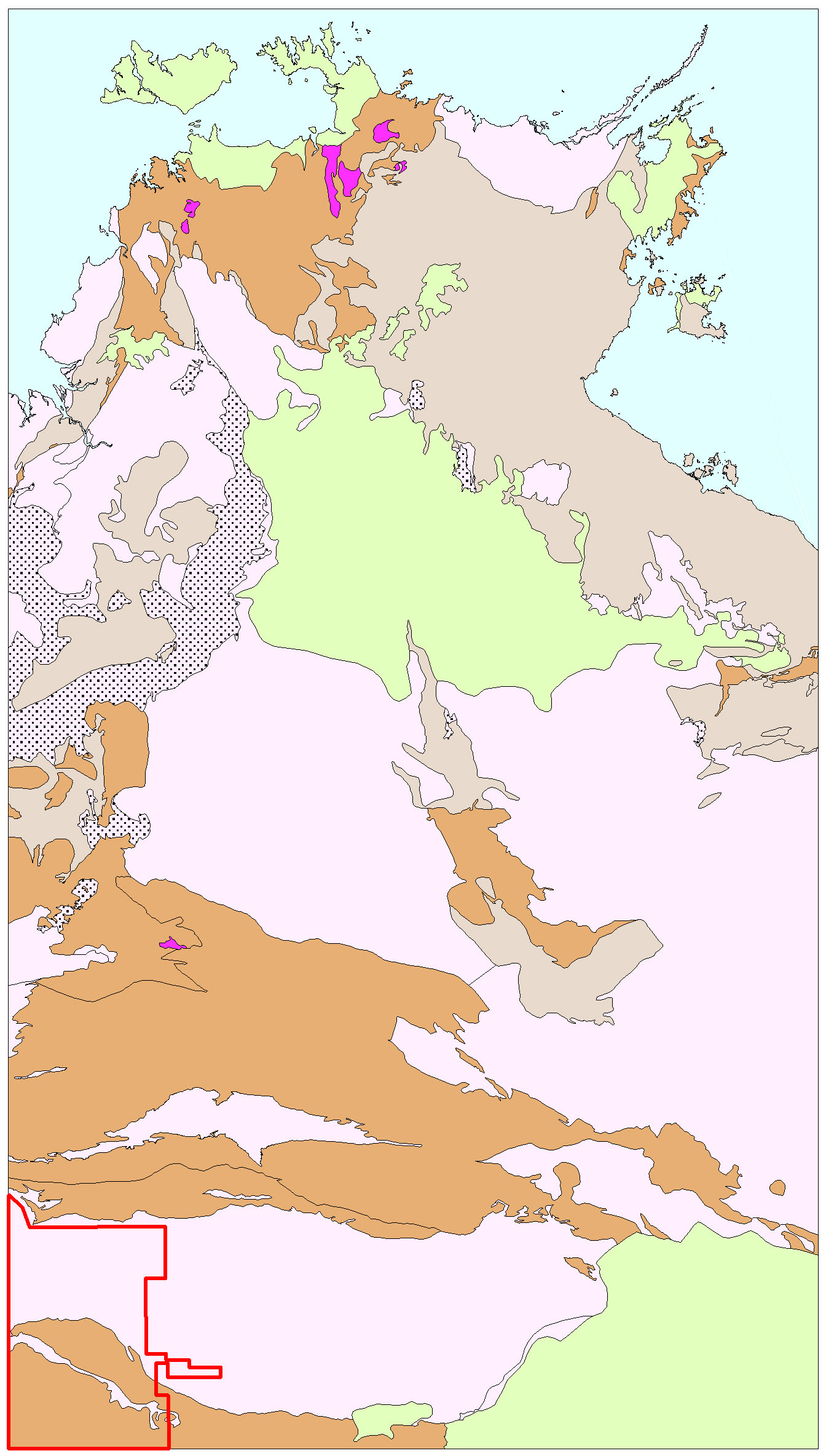
|
Southern McArthur Basin Gravity Survey 2013The Southern McArthur Basin Gravity Survey acquired gravity data over an area of approximately 75,000 square km, south of the Roper River, in the McArthur Basin, Northern Territory. The survey consists of 4614 stations at 4 km spacing funded under the Creating Opportunities for Resource Exploration (CORE) initiative. Industry collaboration funded the collection of another 1657 stations to infill two areas, totalling 8640 square km, to 2 km spacing. | 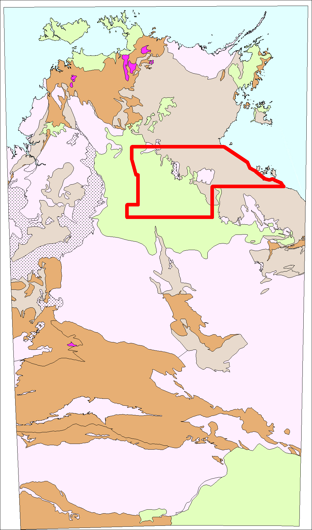
|
Southern Wiso Basin Gravity Survey 2013The Northern Territory Geological Survey has completed the Southern Wiso Basin Gravity survey in central Northern Territory. Over 3800 helicopter supported ground gravity stations were collected covering 60,000 km2 between Tennant Creek and the Tanami region at a station spacing of 4 km. |
Give feedback about this page.
Share this page:
URL copied!