Mapping the Territory’s savanna with earth observation data
Intelligent use of satellite data will enable a local company to map the Territory’s vast savannas more accurately.
Maitec, which develops and operates remote sensing systems for environmental monitoring, received a $63,650 grant under Earth Observation for the NT, known as EO4NT, an innovative grant program delivered in partnership by the Territory Government and Geoscience Australia.
The grant will be used to develop a computer system that automatically produces weekly maps of biomass for northern Australia's savannas using satellite data.
The NT’s tropical savannas are 2-layer vegetation systems - a grass or shrub understorey and a dense tree canopy.
Maps will provide separate biomass estimates for the understorey and the tree canopy.
Knowledge of understorey biomass is essential for:
- Bushfire management as ground biomass is the fuel that drives fire risk.
- Pasture management as ground biomass is feed for cattle. Knowledge of actual feed available allows better informed stocking rate decisions. Too low stocking rates lead to underuse of available feed and increased fire risk. Too high stocking rates lead to land degradation, which reduces productivity in the long term.
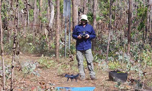
Drones will be used to develop and assess the accuracy of the satellite-based maps.
Maitec founder Dr Stefan Maier says estimating the biomass is currently difficult because of the strong seasonal variations and vast distances involved.
EO4NT aligns with recommendations from the Territory Economic Reconstruction Commission to drive earth observation data in the NT’s key industries and to demonstrate to Territory businesses the productivity and efficiency improvements made possible through use of the technology.